Chalgrave Parish Survey 1986

This is a survey made in 1986 by Stephen R Coleman of what was then, Beds County Council, on the Historic Landscape and Archaeology of Chalgrave. Updates, for example where things have changed since the publication date and notes, have been added in italics.
- Chalgrave Survey 1986 – This is the complete 66 page publication with text, diagrams, and photographs.
The front cover picture is believed to be a view from Toddington Road where the St Marys bungalows are now, looking up the drive to Tithe farm with the Wingfield road on the left.
Parish Survey Maps
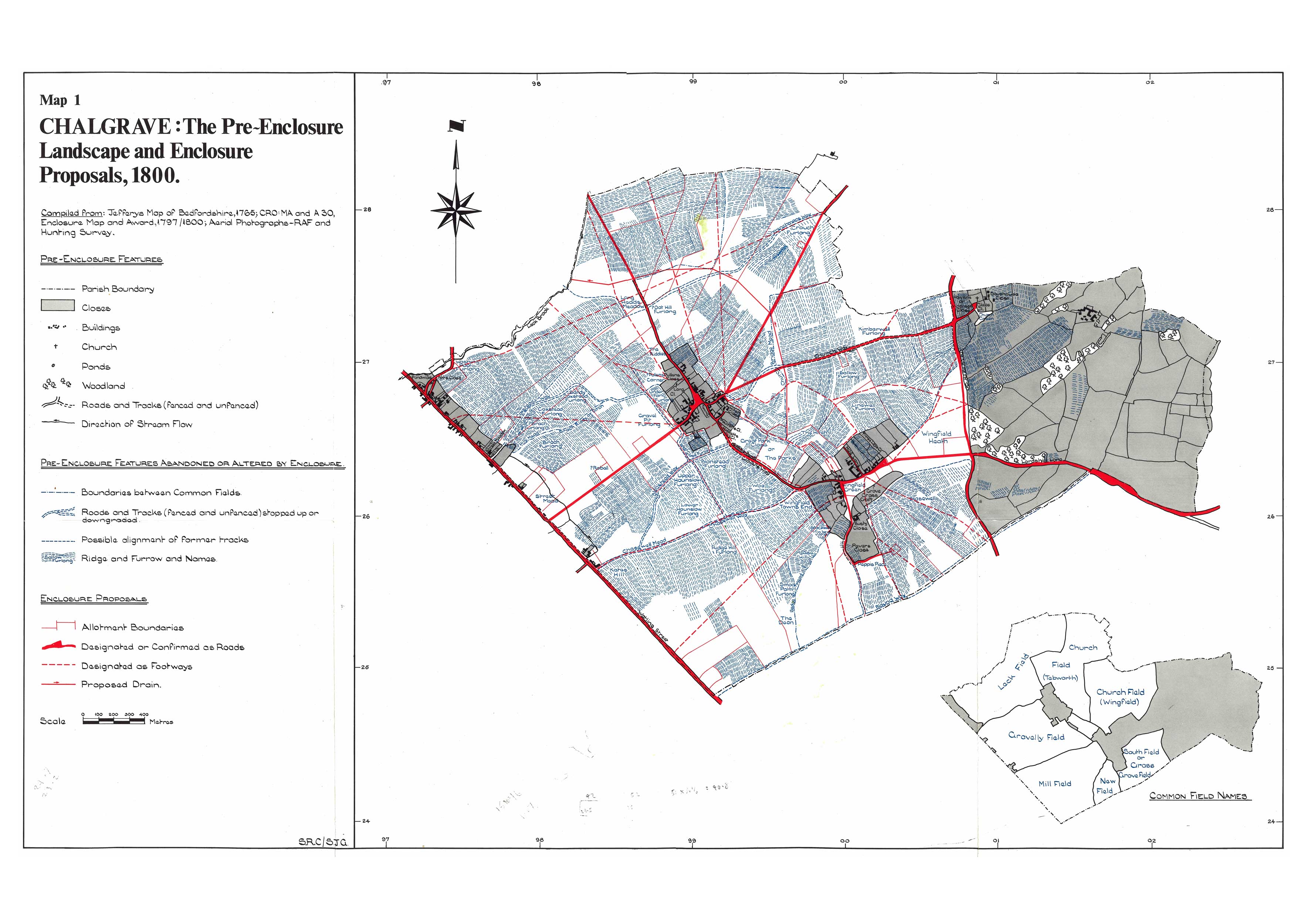
Map 1
This is a map of the pre-enclosure landscape and enclosure proposals of 1800. You can see the old roads that were stopped up or downgraded and the new designated roads.

View JPG image or PDF version.
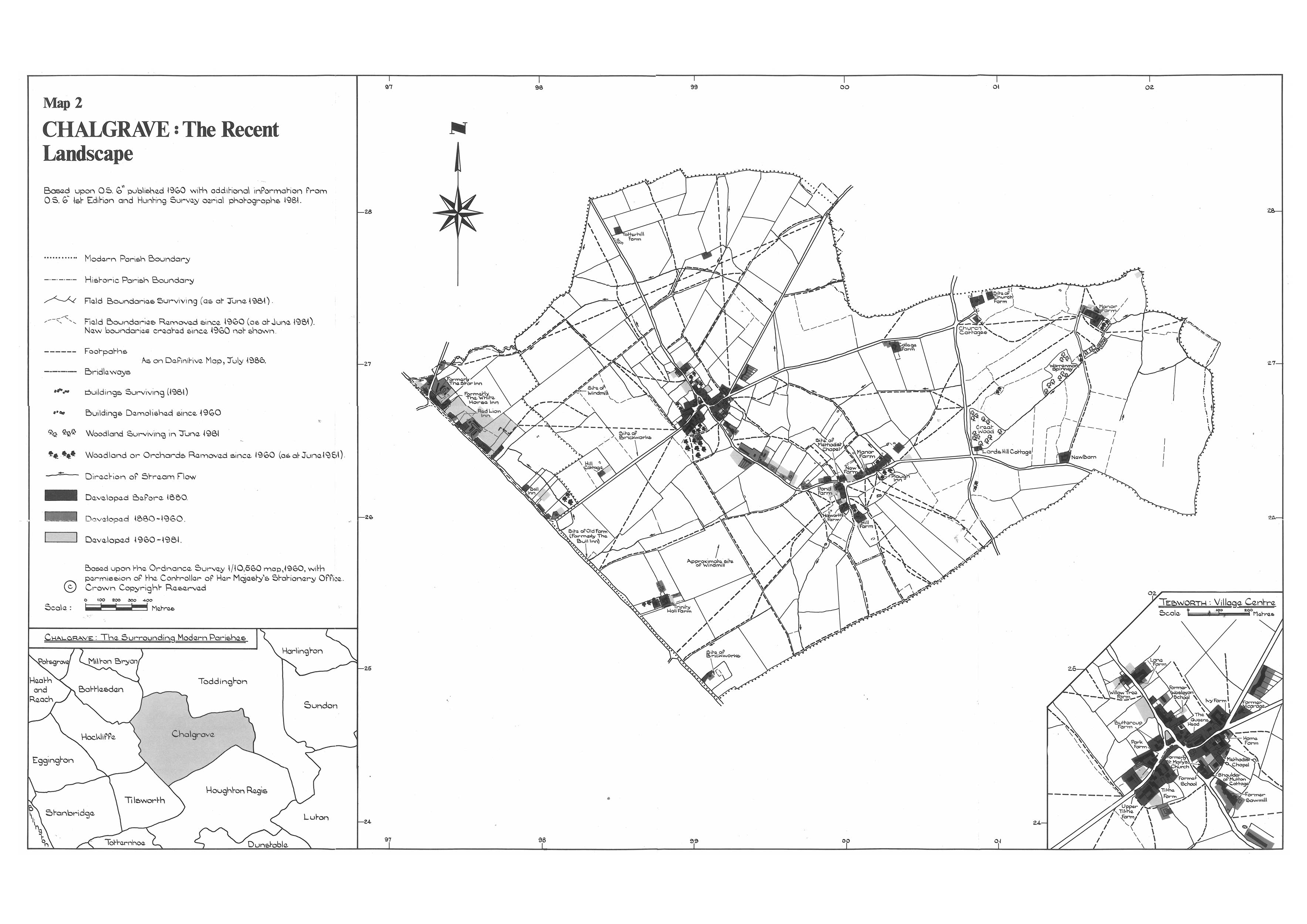
Map 2
This map shows the recent landscape based on the 1960 OS map where you can see sites of windmills and brickworks etc.

View JPG image or PDF version.